Light Pollution Map
Research AI Tools
Explore a global light pollution map to get a Bortle rating, SQM estimate, and nearby dark-sky spots for better stargazing.
- Pricing
- Free
- Category
- Research
- Listed
- Aug 26, 2026
- Updated
- Aug 26, 2026
Promoted
 Sidrune AI85% off. Stable Claude API for agent developers. Pay as you go. Invoices & refunds available.
 Pixmax.aiPixmax.ai is an all-in-one AI workspace for videos, visual stories, and marketing content.
 RewindType any X/Twitter handle. Get their year back as a narrated video story. Then ask it anything.
 KurodyneSell the tools from your AI side projects. Listing is free.
 SEOify - Improve your SEO & rankingsBuild links to rank in Google. Improve your DR with links you can start building now.Advertise here270,000+ people visit Dang.ai every month.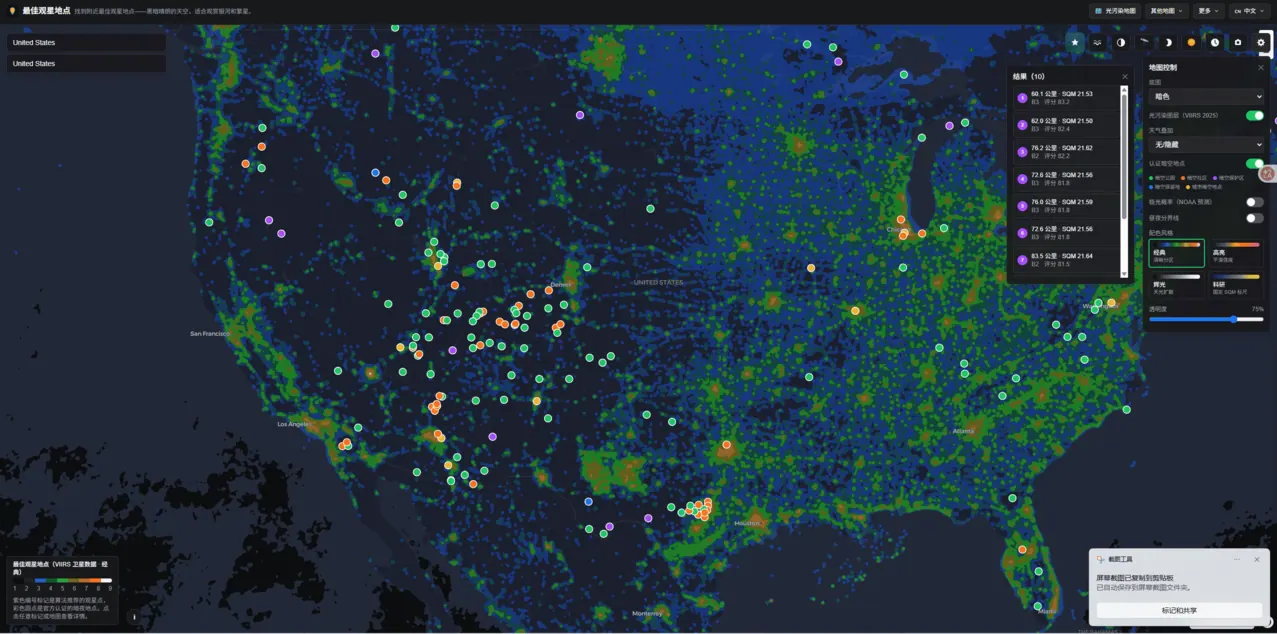
What does Light Pollution Map do?
Light Pollution Map is an interactive light pollution map and dark sky finder designed for anyone planning clearer night-sky views. Click anywhere on Earth to see the local Bortle Scale class along with an approximate Sky Quality Meter (SQM) value, helping you quickly compare how bright the sky is in different locations.
Use it to plan stargazing and trips: look for the darkest areas on the map to find certified dark sky places and low-light zones. It also supports practical observing planning by pairing darkness data with meteor shower forecasts and aurora probability, so you can choose a site and align it with what you want to see.
Additional layers and tools help you refine decisions before you go. Toggle weather overlays, view moon phase and golden hour info, and use sky photo analysis to understand what the night sky will look like from your chosen location.
What can I do on Light Pollution Map?
Click on the map anywhere to get a Bortle Scale rating and an approximate SQM value for that spot, then use the nearby dark-sky finder to locate better viewing locations.
How do the Bortle Scale and SQM relate to each other?
The Bortle Scale is a 1–9 rating of sky darkness, where Bortle 1 is the darkest and Bortle 9 is the brightest city sky. The map uses SQM (Sky Quality Meter) as the underlying basis for brightness measurement at each location.
How should I pick a location for Milky Way viewing?
Aim for darker Bortle readings (often Bortle 4 or darker) and consider timing around the new moon for the clearest Milky Way visibility.
Can I use this map for astrophotography?
Yes—brighter skies typically require shorter exposures, so check the map’s light pollution reading before choosing a starting exposure time.
Does the map help with meteor showers and auroras?
Yes. Combine the darkness map with a meteor shower forecast to plan where to observe, and enable the aurora probability layer to assess northern lights visibility odds for your latitude while avoiding local skyglow.
Is there a way to jump to a specific city or region?
You can search directly for locations in the map’s search bar (from broad regions down to specific cities) to instantly view that spot’s Bortle and SQM readings.
This listing is claimed
Own Light Pollution Map? Sign in with the email used to claim it to manage this listing, or upgrade to Pro for featured-first placement and a newsletter feature.